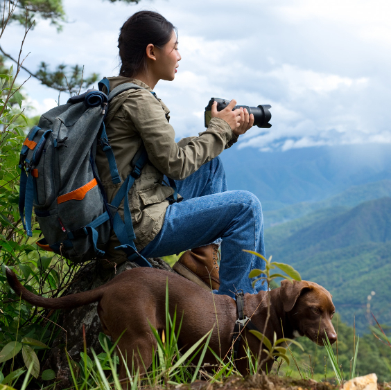
The Kanchenjunga Circuit Trek is one of Nepal’s last true expedition-style Himalayan journeys — physically demanding, isolated, and deeply rewarding. Compared to the more commercial trekking regions of Everest, Annapurna, and Langtang, the trails around Kanchenjunga remain wild, secluded, and largely untouched by modern development. This route explores both the North and South Base Camps of the world’s third-highest mountain, passing through ancient forests, glacial valleys, Tibetan Buddhist villages, and some of the most dramatic alpine scenery in the Himalayas. The Kanchenjunga Base Camp trek begins in Bhadrapur (91 m) in Nepal’s lowlands and gradually ascends through Himalayan valleys to Pangpema (5,143 m), the North Base Camp of Mount Kanchenjunga. From Kathmandu, the journey continues with a flight to Bhadrapur, followed by an overland drive through the tea-covered hills of Ilam into the mountain district of Taplejung. From Suketar, rugged jeep roads descend into the deep Tamur River valley before the trekking route enters the isolated Ghunsa Valley. As elevation increases, the landscape transforms dramatically. Subtropical forests give way to alpine terrain, glacial moraines, and towering Himalayan peaks. Traditional settlements such as Ghunsa and Khambachen offer rare insight into Tibetan-influenced mountain culture, where prayer flags, monasteries, yak pastures, and centuries-old traditions remain an essential part of daily life.
The northern section reaches Pangpema, also known as Kanchenjunga North Base Camp, where massive glaciers and the towering north face of Kanchenjunga dominate the horizon. This high-altitude wilderness feels more like a true Himalayan expedition than a standard trekking route, with moraine trails, glacial terrain, and vast mountain panoramas in every direction. Crossing into the southern circuit, the route traverses high Himalayan passes including Sele La, Mirgin La, and Sinelapche La. These exposed crossings provide sweeping views of Jannu, Makalu, Baruntse, and the greater Kanchenjunga massif. The journey then continues into the Yalung Valley toward Kanchenjunga South Base Camp at Oktang, where dramatic ice walls and glacial formations create one of the finest viewpoints in Nepal. Beyond the high mountains, the trail descends through rhododendron forests, traditional Limbu villages, terraced hillsides, and peaceful river valleys. The final days reveal the cultural diversity of eastern Nepal, where Limbu, Rai, Sherpa, and Gurung communities continue to preserve authentic Himalayan lifestyles far from the main trekking corridors. This Kanchenjunga trekking experience is ideal for experienced trekkers seeking a challenging Himalayan adventure away from crowded routes. The combination of high mountain passes, glacier landscapes, cultural immersion, and untouched wilderness makes it one of the most rewarding long-distance treks in Nepal. With basic lodges, long walking days, and demanding altitude conditions, the journey offers a true expedition atmosphere from start to finish — a rare experience in the modern Himalayas.
Today, you take a morning flight from Kathmandu to Bhadrapur (91m) in eastern Nepal, offering a change in landscape from the Himalayan valleys to the lowland Terai region. Upon arrival, the journey continues by road toward the hill town of Ilam, known for its green tea gardens and rolling landscapes. The drive gradually ascends through winding roads, passing rural settlements, terraced hillsides, and lush subtropical scenery. As you gain elevation, the air becomes cooler and the surroundings turn increasingly green and forested, marking a clear transition into eastern Nepal’s mid-hill region. After approximately 5 to 6 hours of combined travel, you reach Ilam (1,667m), a peaceful town surrounded by tea plantations and soft rolling hills. Overnight in Ilam.
Today you continue the journey into eastern Nepal, driving from Ilam toward Suketar (2,420m). The route gradually climbs through winding hill roads, passing tea- and cardamom-covered slopes, small settlements, and forested ridgelines that define the mid-hill landscape of the region. As the drive gains elevation, the scenery becomes cooler and more alpine in character, with expanding views of rolling hills and distant mountain horizons. The journey offers a gradual transition from Ilam’s tea-growing landscapes into the higher terrain around Taplejung. Along the way, weather permitting, there are your first magnificent views of Mount Kanchenjunga, the world’s third-highest mountain. The drive continues through the busy market town of Taplejung before climbing further uphill to Suketar. After several hours of driving, you reach Suketar (2,420m), a quiet hilltop settlement known for its small airstrip and wide Himalayan foothill views. Here, you meet the rest of the trekking crew, porters and make final preparations before the trek begins.
Today the journey leaves the hilltop landscapes around Suketar and descends into the deep Tamur River Valley, following the river through remote mountain terrain toward Sekathum. The drive is best done by 4WD jeep, as the road is rough and bumpy. Built in 2020 to support a hydroelectric project in Sekathum, this road has significantly shortened the trek by replacing the previous two-day walk between Suketar and Sekathum. The route passes through terraced hillsides and fertile farmland producing rice, millet, potatoes, and seasonal vegetables, while cardamom — one of the region’s main cash crops — is widely cultivated on the forested slopes. On clear days, the first views of the high Himalayas begin to appear, including Jannu (Kumbhakarna) rising dramatically above the Ghunsa Valley. After reaching Sekathum (1,660m), you stay overnight at one of the best available lodges in the village.
Today’s trek follows the Ghunsa River Valley as the route gradually leaves the lower subtropical zone and enters a more remote Himalayan landscape. From Sekathum, the trail crosses a suspension bridge and continues along narrow paths carved into steep river gorges. The route alternates between forest sections, rocky trails, and river crossings, with steady ascents and descents requiring consistent walking. Dense vegetation, waterfalls, and deep valleys define this section of the Kanchenjunga region in eastern Nepal, creating a more isolated and atmospheric trekking experience. As elevation increases, the environment becomes cooler and more alpine, with pine and bamboo forests dominating the slopes. Occasional glimpses of distant ridgelines hint at the higher Himalaya ahead. After approximately 5 to 6 hours of trekking, the trail climbs to Amjilosa (2,510 m), a small hillside Tibetan settlement surrounded by forested ridges. After check-in at the lodge, you can explore the village and enjoy views of surrounding unnamed peaks from the lodge.
Today’s trek continues through the remote Ghunsa Valley, steadily gaining elevation into a more alpine Himalayan environment. From Amjilosa, the trail follows a river gorge landscape with multiple waterfalls and forested slopes covered in bamboo, pine, and rhododendron, gradually ascending into higher terrain. The route includes undulating terrain with both gradual ascents and short descents, crossing small streams and sections of narrow mountain trail. As the altitude increases, the landscape becomes quieter and more rugged, with fewer settlements and a stronger sense of isolation in the Kanchenjunga region. After approximately 5 to 6 hours of trekking, you arrive in Gyabla (2,730 m), a small settlement surrounded by forested hills and alpine scenery, where you overnight in a mountain lodge
Leaving the forested settlement of Gyabla, the valley gradually widens as the trail follows a comparatively easier section through alpine Himalayan forest toward Phale. As the route ascends into a higher alpine Himalayan environment, temperatures steadily drop and the landscape transforms into pristine mountain scenery. Lower-altitude vegetation gives way to alpine forests of rhododendron, bamboo, juniper, and coniferous trees, while the elevation continues to increase.Along the way, the trail passes through river valleys, dense forest, and a seasonal winter settlement traditionally used by villagers from Ghunsa before reaching Phale. This small Tibetan-influenced settlement is known for its Buddhist monastery and traditional carpet weaving, where handmade rugs and local handicrafts are still produced by local families. From Phale, the trek continues gradually along the upper Ghunsa Valley through open meadows and forested slopes. Shortly before reaching Ghunsa, the route to Nango La (4,795 m) branches off toward the ancient trading village of Olangchung Gola near the Tibet border. The main trail then descends toward the Ghunsa Khola, passing the historic Tashi Choding Gumba before crossing a suspension bridge into Ghunsa village. At Ghunsa (3,600 m), traditional wooden houses decorated with colourful Buddhist prayer flags reflect the village’s strong Tibetan Buddhist heritage. One of the largest settlements in the upper Kanchenjunga region, Ghunsa offers trekking lodges, small shops, and a local office of the Kanchenjunga Conservation Area, where you stay overnight in a mountain lodge.
A rest and acclimatization day in Ghunsa is an important part of the trek in the upper Kanchenjunga region. The main purpose is to help your body adjust to the higher altitude and reduce the risk of altitude sickness before continuing further into the mountains. On this day, trekkers usually take short hikes around the village or climb nearby viewpoints to support acclimatization while staying active. Popular options include walks toward ridges, monasteries, or upper valley trails with views of snow-covered peaks and glacial landscapes. A recommended hike is to Lobsang La, approximately 400 m above Ghunsa, which takes about 5 hours in total (around 3 hours to ascend and 2 hours to return). The rest of the day is spent hydrating, resting, and exploring the village’s cultural atmosphere.. Overnight in Ghunsa.
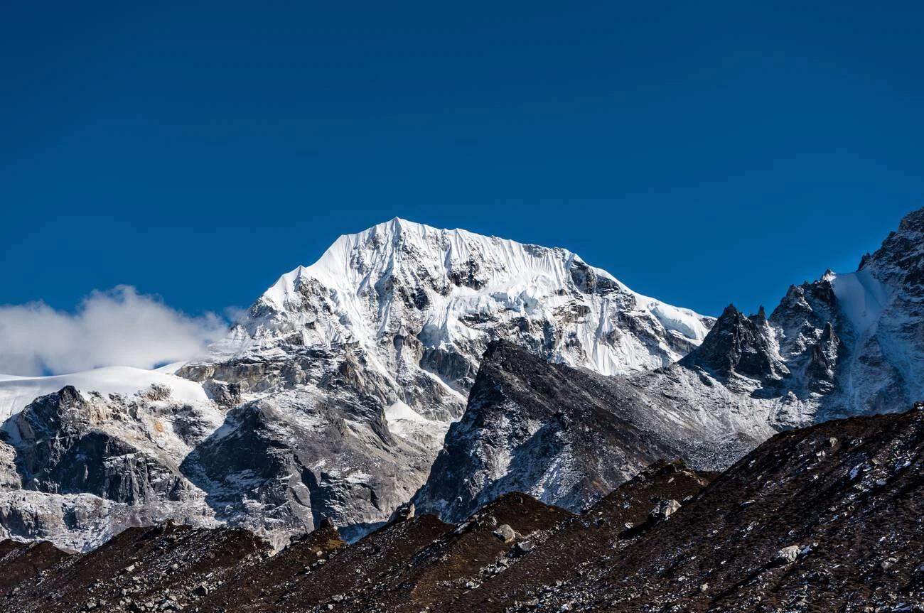
Beyond Ghunsa, the trail enters a stark high-altitude Himalayan environment in the Kanchenjunga region. The landscape is dominated by the massive walls of the Kanchenjunga Massif and the striking pyramid of Jannu (7,710 m). These peaks rise abruptly from a broad glacial valley carved by long-retreated ice, forming one of the most dramatic sections of the entire trekking route. The terrain becomes increasingly rugged and alpine. The trail is often faint or eroded, crossing moraine, loose scree, and rocky debris left by ancient glaciers. In many sections, navigation feels closer to a high-altitude expedition than a defined trekking path, especially where landslide zones and boulder fields reshape the valley floor. The route continues toward Khambachen (4,200 m), a seasonal pasture settlement used by local herders. It consists of simple, basic lodges set on a wide grassy plain, surrounded by rock, ice, and towering Himalayan peaks. This remote section is also one of the best wildlife zones in eastern Nepal. Himalayan blue sheep (bharal), Himalayan tahr, and mountain goats are sometimes seen on steep slopes, while marmots and pikas live among the rocky outcrops. Overnight in one of the best lodges in Khambachen.
Today is a rest and acclimatization day. The purpose of the day is to allow the body to adjust to higher altitude before continuing toward Kanchenjunga Base Camp. In the morning, we take a short hike to a nearby viewpoint with clear views of Mount Jannu (Kumbhakarna). The trail offers beautiful scenery of surrounding mountains, sweeping views of glaciers, steep alpine slopes, and deep valleys shaped by ancient ice. In the afternoon, there is time to rest and explore the area at a relaxed pace. Overnight in Khangpachen.
Today’s trek enters the remote high-altitude wilderness of the upper Kanchenjunga Region as the trail gradually ascends beyond Kambachen along the lateral moraine of the Kanchenjunga Glacier. The landscape becomes increasingly stark and alpine, with rocky glacial terrain, moraine slopes, and wide valleys shaped by ancient Himalayan ice flows. Early in the day, the route passes the seasonal yak herder settlement of Ramtang (4,370 m), where simple stone shelters and high grazing pastures reflect the traditional mountain lifestyle of the upper Kanchenjunga Himal. As altitude increases, vegetation becomes sparse, with only scattered alpine shrubs and hardy juniper surviving among the exposed rocky slopes. Beyond Ramtang, the terrain becomes increasingly rugged and exposed, with the trail crossing unstable moraine, loose scree, and landslide-prone sections requiring careful footing. Throughout the day, dramatic mountain views unfold across the surrounding Himalayan peaks, including Wedge Peak (6,750 m), Nepal Peak (6,910 m), and The Twins (7,351 m), among many others. After approximately 4–5 hours of trekking, the route reaches Lhonak (4,790 m), a remote high-altitude settlement set on a broad glacial plain beneath the towering peaks of the upper Kanchenjunga region.Water availability here can vary by season, and camps or lodges are typically positioned beside large boulders that provide shelter from strong mountain winds. The surrounding landscape of glaciers, icefall valleys, and snow-covered ridgelines creates one of the most dramatic high-altitude settings in eastern Nepal. Overnight at a basic mountain lodge in Khambachen
Today is one of the most demanding and rewarding days of the Kanchenjunga North Base Camp trek, leading deep into the remote glacial wilderness beneath the north face of Kanchenjunga, the world’s third-highest mountain. Leaving Lhonak early in the morning, the trail follows a gradual but steady ascent across rocky lateral moraine, glacial debris, and high-altitude alpine terrain alongside the upper Kanchenjunga Glacier for about two hours. At this elevation, the landscape is almost entirely barren, shaped by ice, wind, and extreme Himalayan weather conditions, with only scattered alpine vegetation surviving among the rocks. As the route progresses deeper into the valley, the surrounding mountain scenery becomes increasingly dramatic, with panoramic views of towering Himalayan peaks, hanging glaciers, and massive ice walls.The trail crosses several sections of loose rock and landslide-prone slopes before gradually climbing toward the stone huts in the grassy basin at Pangpema, reached after a further three hours of trekking. Weather conditions in this area can change rapidly, with strong winds and cold temperatures common even during the main trekking seasons. From Pangpema, trekkers are rewarded with some of the finest high-mountain panoramas in Nepal, including close views of Kanchenjunga’s north face and surrounding peaks such as Chang Himal, Jannu, and nearby glacier systems extending across the upper valley.after spending time at base camp for rest, photography, and mountain views, the route retraces the same glacial trail back to Lhonak. The return journey requires careful pacing due to the high altitude and long trekking duration, with a total walking time of approximately 8 to 9 hours for the day. . Overnight at a basic mountain lodge in Khambachen.
Today is a return journey from the high glacial wilderness of Lhonak back to Ghunsa. With decreasing altitude, breathing becomes noticeably easier and temperatures gradually rise, allowing for a faster and more comfortable trekking pace compared to the ascent days. The return journey also offers a new perspective of the same Himalayan landscape, with broader valley views and clearer sightlines toward distant peaks that were less visible during the climb. The descent requires steady footing across moraine and uneven glacial terrain, where loose rocks can feel more unstable on downhill sections. Passing again through the Kambachen valley section, the contrast between the stark alpine wilderness and the deep river valleys becomes increasingly clear, highlighting the dramatic elevation changes of the Kanchenjunga Himal. Further down, vegetation gradually reappears—first as scattered alpine shrubs, then juniper and rhododendron forests—marking the transition from high glacial terrain back into a more inhabited Himalayan environment. The final section gradually descends into the forested approach to Ghunsa, where the sound of the river returns and lodges and prayer flags reappear along the trail. The trek concludes in the village for the night. Overnight in Ghunsa
After leaving Ghunsa, the trail begins a steady ascent along a traditional shepherds’ route. The path climbs through dense mixed forests of birch, pine, and rhododendron, gradually moving out of the river valley into a colder and more open alpine environment. As elevation increases, the landscape becomes more rugged and remote, with wider views over deep valleys and surrounding Himalayan ridgelines. The forest slowly thins, giving way to open alpine terrain where vegetation becomes sparse and the trail more exposed. The ascent continues along a steep ridge section leading to Sele La Pass (4,290 m), a high Himalayan crossing point with wide views of the surrounding peaks and valleys. At this altitude, the air becomes noticeably thinner and the terrain more exposed, marking a clear transition into a true high-mountain environment. Depending on the season, sections of the trail may be covered with snow or ice, requiring careful footing and steady pacing. From the pass, High Camp can be seen in a protected valley a short walk away, giving a clear idea of the descent ahead. A further 30 minutes of trekking leads to High Camp, a well-positioned high-altitude stop with wooden lodges located near a small alpine lake. On clear days, distant Mount Makalu can be seen on the horizon, adding to the vast Himalayan scenery. Today’s accommodation is in a simple mountain lodge with very basic facilities at High Camp, surrounded by remote alpine scenery.
An early start (around 5:30–6:00 AM) is recommended to avoid strong afternoon winds and rapidly changing weather conditions An early start (around 5:30–6:00 AM) is recommended to avoid strong afternoon winds and rapidly changing weather conditions while crossing the high passes. Today is one of the most dramatic high-altitude crossing days of the trek, traversing a series of Himalayan passes in remote alpine terrain. The trail first ascends steadily to Sinion La (4,440 m), a high saddle offering wide views across glacial valleys and surrounding ridgelines. From here, the route contours along exposed mountainsides before climbing to Mirgin La Pass (4,480 m), a scenic crossing point with expansive Himalayan panoramas. Mirgin La offers one of the finest viewpoints of Kumbhakarna (Jannu Himal), with distant views of Makalu, Baruntse, and Chamlang rising above the surrounding mountain ranges. Continuing across rugged high-altitude slopes, the trail alternates between short ascents and traverses through a remote alpine environment before reaching the highest point of the day at Sinelapche La Pass (4,840 m). From the top, trekkers are rewarded with sweeping views of the Kanchenjunga massif, surrounding peaks, and deep valleys carved by ancient glaciers. After crossing the passes, the long descent to Tseram (3,870 m) is equally demanding and requires caution on steep and uneven sections. Due to the remoteness of the route, a packed lunch is usually necessary, as there are no permanent teahouses or settlements between High Camp and Tseram. Carrying high-energy snacks and warm drinks in a thermos is also recommended, especially during cold or windy conditions. The day ends at Tseram, a quiet settlement above the Simbua Khola, where we stay overnight in a simple mountain lodge after a challenging and highly scenic high-pass crossing.
Today’s journey continues deeper into the upper Yalung Valley, entering one of the most dramatic high-alpine environments in the Kanchenjunga region. The trail gradually ascends from Tseram, following the course of the Simbua Khola as the landscape transitions from rugged valley terrain into a broad glacial basin shaped by the Yalung Glacier system. The morning section of the trek offers a steady climb through open alpine ground, with expanding views across moraine ridges, glacial streams, and vast mountain walls. As altitude increases, vegetation becomes sparse, and the scenery shifts into a raw high-Himalayan wilderness framed by distant snow peaks along the India–Nepal border, including Koktang (6,147m), Rathong (6,679m), and the Kabrus rising above 7,000m. By midday, the route reaches Ramche (4,580m), a remote alpine outpost set beneath the towering south face of the Kanchenjunga massif. The area features a small glacial lake, seasonal meadow patches, and simple stone shelters that reflect life in this extreme mountain environment. This is also a known grazing zone for blue sheep, occasionally seen on the surrounding slopes. In the afternoon, an optional excursion continues further into the ablation valley toward Oktang (4,730m), one of the most iconic viewpoints in the Kanchenjunga region. From here, trekkers are rewarded with a powerful close-up panorama of the southwest face of Mount Kanchenjunga and its massive ice walls. The viewpoint also reveals the historic climbing line first successfully used during the 1955 ascent by Joe Brown and George Band, adding a strong mountaineering heritage element to the experience. After soaking in the high-altitude panorama, the trail returns to Ramche for overnight stay, surrounded by a quiet glacial wilderness deep within the Kanchenjunga Conservation Area.
After exploring the high glacial landscapes near Kanchenjunga South Base Camp, today’s trek descends from the remote alpine wilderness of Ramche back toward the lower valleys of the Kanchenjunga region. The route retraces the trail through the upper Yalung Valley, offering a final look at the dramatic snow-covered peaks, glacial moraines, and rugged mountain terrain surrounding the Yalung Glacier system. The descent passes through open alpine landscapes before gradually entering greener terrain as elevation decreases. Along the way, trekkers follow scenic mountain paths beside the Simbua Khola, crossing rocky sections, yak pastures, and rhododendron-covered hillsides characteristic of eastern Nepal’s Himalayan trails. As the trail continues downward, the environment c. hanges noticeably from stark high-altitude scenery to dense forested valleys filled with pine, juniper, and rhododendron vegetation. The warmer air and lower elevation provide a welcome transition after several days spent in the extreme alpine zone. By late afternoon, the trek reaches Tortong (3,000m), a peaceful riverside settlement surrounded by forest and mountain landscapes within the Kanchenjunga Conservation Area. Overnight stay is at a simple mountain lodge, offering a comfortable rest before continuing the journey toward lower valleys and traditional Himalayan villages.
Today’s trek continues through the lower valleys of the Kanchenjunga region, descending from the forested mountain landscapes around Tortong toward the culturally rich settlement of Yamphudin. The route follows scenic Himalayan trails through dense rhododendron and pine forests, crossing suspension bridges, cascading streams, and remote hillside terrain shaped by the powerful river systems of eastern Nepal. Leaving Tortong, the trail ascends steadily through densely forested hillsides of rhododendron, pine, and bamboo, following a remote mountain route above the Simbua Khola. Early in the day, the path crosses several landslide-prone sections where careful footing is required, particularly after rain or during unstable weather conditions. The climb continues gradually through quiet forested slopes and narrow mountain trails, with occasional clearings offering views of the surrounding hills and deep river valleys. After about three hours of steady ascent, the trail reaches Lamite Bhanjang, a quiet ridge area commonly used as a lunch stop along this section of the trek. Beyond the ridge, the route begins a long descent through peaceful forest corridors rich in biodiversity, offering opportunities to observe native Himalayan flora, birdlife, and traditional mountain lifestyles rarely seen on more commercial trekking routes in Nepal. As the elevation decreases, the environment becomes noticeably warmer and greener, with terraced farmland, cultivated hillsides, and scattered mountain settlements gradually replacing the remote alpine scenery of the higher valleys. The route later crosses the Imja Khola before continuing along contouring mountain paths toward Yamphudin (2,080 m), one of the larger and most culturally diverse villages in the region. Inhabited by Limbu, Rai, Gurung, and Sherpa communities, this charming settlement offers a fascinating glimpse into the traditional lifestyles and ethnic diversity of eastern Nepal’s Himalayan foothills. Overnight stay is at a simple mountain lodge surrounded by forested hills and terraced farmland.
Today’s trek follows a scenic section of the Kabeli Valley, offering a rewarding mix of cultural encounters and beautiful Himalayan landscapes. Leaving Yamphudin behind and passing through Sherpa Gaun, the trail gradually winds alongside the Kabeli River through peaceful forests, terraced farmland, and traditional Limbu settlements. After crossing several small streams and suspension bridges, the route climbs toward Mamankhe, a picturesque Limbu village known for its rich local culture and traditional mountain lifestyle. Depending on time and availability, trekkers may have the opportunity to visit the village school, health post, or a small museum showcasing the heritage and traditions of the Limbu community. From Mamankhe, the trail descends to the Khaksewa River before a steady uphill climb leads to Phumpe Danda. As you approach the settlement, the landscape opens up to impressive views of Mount Kumbhakarna, Ghabur Peak, Boktoh Peak, and the surrounding valleys. Overnight stay at a local lodge in Phumpe Danda
After spending the night at Phumpe Danda, we begin our final day of trekking with an early morning walk toward Kande Bhanjang. The trail passes through peaceful forests, open pastureland, and traditional hillside settlements, offering a final glimpse into the remote beauty of the lower Kanchenjunga region. After a short climb to Deurali, the route descends along a narrow path to Yangpang before ascending gradually again for around 45 minutes to reach Phungphung Danda (1,794 m). The trail then continues to Yanthung and passes through wooded terrain and a small waterfall area before reaching Khesewa. From Khesewa, it is a final half-hour walk that brings us to Kande Bhanjang, a ridge-top settlement with wide mountain views, including Kanchenjunga, Yalung Kang, Ghabur Himals and the surrounding Himalayan ranges. The area is home to a diverse mix of Limbu, Gurung, and Hindu communities, reflecting the rich cultural heritage of eastern Nepal. As the final trekking day of the Kanchenjunga journey, the evening becomes a special occasion to celebrate the successful completion of the trek and to share farewell moments with the trekking crew, porters, and staff who accompanied us through the mountains. Traditionally, this is also an appropriate time to offer tips and express gratitude to the guides, porters, and support team for their dedication, hard work, and companionship throughout the expedition.
Today we begin the return journey from the remote Kanchenjunga trekking region, traveling by jeep from Kande Bhanjang to Suketar near Taplejung. The route follows a challenging Himalayan mountain road where a reliable 4WD vehicle is essential due to steep ascents, narrow bends, and long stretches of rough, dusty, and uneven terrain. Road conditions can vary significantly depending on weather, making the drive both adventurous and unpredictable. Along the way, the route passes through isolated hillside settlements, terraced farmlands, and forested ridges, offering final panoramic views of the eastern Nepal Himalayas. This scenic drive provides a last opportunity to experience the raw and untouched beauty of the Kanchenjunga region. The journey concludes at Suketar (2,420 m), a peaceful hilltop location known for its small airstrip and sweeping mountain vistas. From here, the remarkable trekking circuit around the Nepalese side of Mount Kanchenjunga comes to an end.
Today we leave the hills of Suketar and begin the long drive down to Bhadrapur in the Terai plains. The journey takes around 10 hours by bus or jeep, though this can change depending on road and weather conditions. The route follows the same road used earlier in the trek, passing back through the tea-covered hills of Ilam. At first, the drive stays high in the mountains with winding, rough sections, before slowly dropping in elevation. The air grows warmer as the landscape changes from green hills to flat lowlands. Along the way, we pass small roadside towns, river valleys, scattered villages, and terraced farmland. Some sections of the road can be bumpy and slow, especially in the hill region, so the drive requires patience. By late afternoon or evening, we reach Bhadrapur (91 m), a busy town near the Indian border, where the mountain journey finally comes to an end. Overnight stay in a hotel in Bhadrapur.
After an early breakfast, transfer to Bhadrapur Airport for your flight back to Kathmandu. Enjoy a scenic aerial view of eastern Nepal before landing in the capital. The rest of the day is free for relaxation, shopping, or optional sightseeing in Kathmandu.
Your Start Date is the day you land in Nepal, and your End Date is when you fly home.
If the set Kanchenjunga Base Camp Trek group dates don’t suit your schedule, we can offer alternative dates upon request.


 (2)
(2)  100% recommend (0)
 (0)
(0)